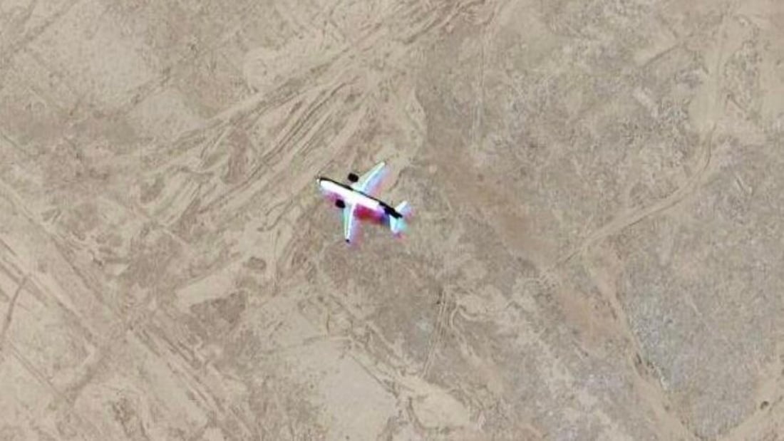
A single-frame satellite capture shows a “ghost aircraft” effect in the Warka desert of Muthanna governorate, where a passing plane briefly appeared on Google Earth before disappearing in later imagery. Photo by 964media.
Viral image debunked
‘Ghost aircraft’ in Iraq’s Muthanna desert was passing plane, not crash site
MUTHANNA — Iraq’s Ministry of Transport said Sunday a satellite image circulating on social media that appeared to show a plane parked in the Warka desert of Muthanna governorate was in fact a still frame of an aircraft captured in flight, not an aircraft on the ground.
In a clarification, the ministry said specialized staff reviewed the image using several satellite platforms, including ArcGIS, Bing Maps and Zoom Earth. The technical check found that “the image in which the aircraft appeared is a single frame only within Google Earth, with no trace in earlier or later images, and it does not appear in any other satellite source outside that single frame.”
The ministry said this points to what it described as the “ghost aircraft” phenomenon, which it called a common issue in satellite imaging. According to the statement, the effect occurs “when a satellite captures a still image at the moment a real aircraft passes overhead, making it appear as if it is on the ground, even though it is at high altitude.” When imagery is refreshed, the shape disappears, confirming that no plane is actually present on the surface.
Officials said similar cases occur in thousands of locations worldwide due to normal air traffic intersecting with continuous satellite photography.